Israel launches missile strikes into Iran, U.S. military official saysIranian news has not reported any such strike and concluded the sounds reported were the interception of one or more drones. Israel's military has not responded to requests for comment.
Play5min 07sec‘It’s such a surreal feeling’: Alissa Pili talks about her future with the Minnesota LynxThis week the Minnesota Lynx put more firepower into their roster in the 2024 WNBA Draft by drafting University of Utah forward Alissa Pili.
Minnesota House approves bill that attempts to speed up legal cannabis marketplace roll outThe proposal would allow pre-approval for dispensaries as soon as this summer while the final rules to regulate the Minnesota marketplace get set. Backers say it’ll get some legwork out of the way now so sales can start quicker, although not all businesses hoping to get into the action like it.
‘Minnesota Voting Rights Act’ nears governor’s signature after state Senate approvalThe bill would cement in law protections previously guaranteed under the federal Voting Rights Act, including the ability to legally challenge vote suppression and other forms of potential discrimination.
Rep. Ilhan Omar’s daughter suspended over pro-Palestinian protest at ColumbiaSeveral students involved in the protest said they were also suspended from Columbia and Barnard College, including Isra Hirsi, who is the daughter of U.S. Rep. Ilhan Omar, a Minnesota Democrat.
Play3min 30secCube Critics discuss ‘Ghostbusters: Frozen Empire’ and ‘The Invisible Fight’Cube Critics Jacob Aloi and Max Sparber discuss a return to a 1980s franchise and an Estonian hard rock martial arts comedy.
Judge in Trump case orders media not to report where potential jurors workThe judge in Donald Trump’s hush money trial ordered the media on Thursday not to report on where potential jurors have worked and to be careful about revealing information about those who will sit in judgment of the former president.
Play3min 56secExpert: large scale PFAS removal will take ingenuity, deep pocketsUniversity of Minnesota Environmental Health Sciences Professor Matt Simcik and All Things Considered Host Tom Crann, discussed the new federal limits on PFAS chemicals in drinking water.
Dickey Betts, founding member of the Allman Brothers Band, dies at 80The influential guitarist, songwriter and singer was best known for the song "Ramblin' Man." Betts's blues, rock and country-influenced guitar style helped define Southern rock in the 1960s and '70s.
Trader Joe’s recalls basil linked to 12 salmonella infections in 7 states, including MinnesotaThe Food and Drug Administration warns Trader Joe’s customers in dozens of states to throw out fresh basil after a federal investigation linked the product to a salmonella outbreak.
Town closes on $17M deal to secure ferry service to Madeline IslandThe purchase is a “critical part of keeping the island population sustainable,” says La Pointe town chair.
Play4min 45secAs hurricanes get more powerful, some scientists suggest a new category sixThat’s out of a recent study in the journal Proceedings of the National Academy of Sciences looking at the link between stronger hurricanes and climate change.
Light pole installation hits fiber line, knocks out 911 service in several statesIt affected services for emergency agencies in Nebraska, Nevada and South Dakota. Federal officials were looking into the outage.
The search for an impartial jury in Trump’s hush money case resumesJury selection continues in the trial focused on the former president. Trump is present in the courtroom while New Yorkers answer personal questions about their ability to serve on the jury.
St. Paul iron foundry faces deadline to fix pollutionThe Minnesota Pollution Control Agency says recent emission records from Northern Iron and Machine Foundry in the Payne-Phalen neighborhood indicate excessive pollution. Regulators say it is “highly likely” that the foundry is emitting levels of lead and particulate matter over federal air quality standards.
Vice President Harris returning to Wisconsin for third visit this yearVice President Kamala Harris plans to return to Wisconsin next week for her third visit to the battleground state this year.
First lady Jill Biden to visit Minnesota on FridayFirst lady Jill Biden will make a brief visit to Minnesota on Friday evening.
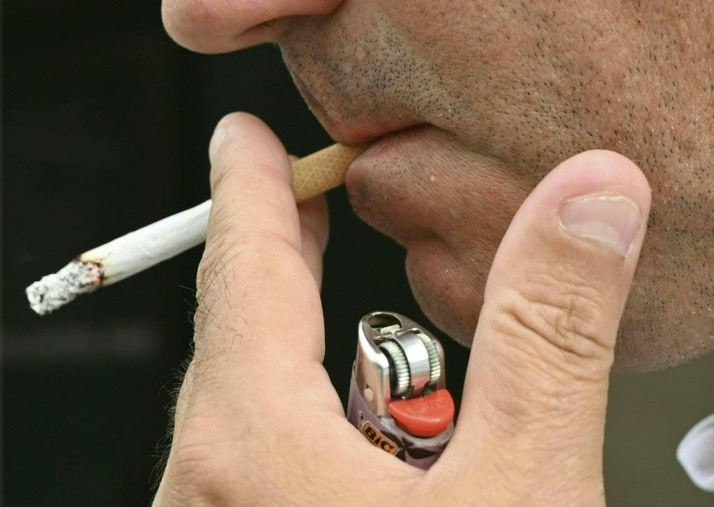
Minneapolis City Council weighs new tobacco rules, including $15 minimum price for cigarettesThe Minneapolis City Council is considering adding new rules and restrictions on sales of tobacco products, including a minimum price for cigarettes and other products that could be the highest in the nation.
Marc-Andre Fleury signs a $2.5M extension with the Wild to return for next season at age 40The Minnesota Wild signed goalie Marc-Andre Fleury to a one-year, $2.5 million contract extension to bring back the veteran for his age-40 season.
Cedric Mullins hits 2-run homer in bottom of the 9th to give Orioles 4-2 win over TwinsCedric Mullins hit a two-run homer in the bottom of the ninth inning to give the Baltimore Orioles a 4-2 victory over Minnesota and a three-game sweep of the Twins.